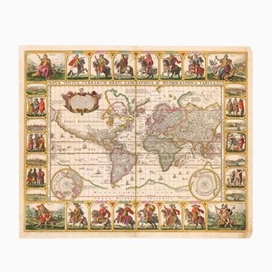
Antique Nova Totius Terrarum Orbis Geographica ac Hydrographica Tabula Claes Map by Janszoon Visscher, 1652
¥3,792,004
You are now following Accessories. You can manage alerts in your account settings.
You have unfollowed Accessories.
Antique Nova Totius Terrarum Orbis Geographica ac Hydrographica Tabula Claes Map by Janszoon Visscher, 1652
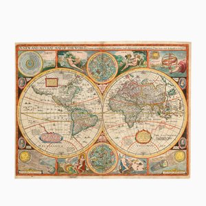
Antique Map of the World after J. Speed, 1651
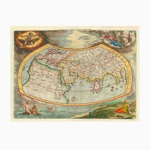
Antique Map of the Ptolemaic World by Gerard Mercator, 1700
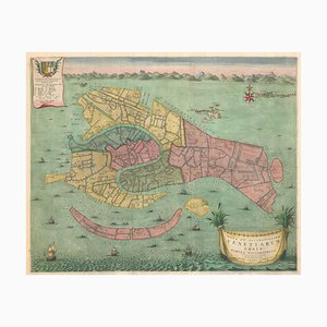
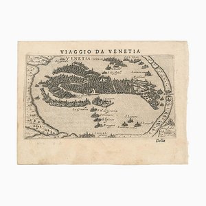
Early 18th Century Map of Venice
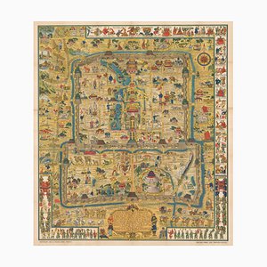
Colourful Map of the History of London, 1970s

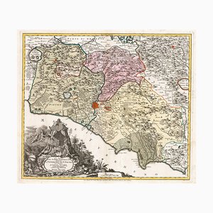
18th Century Map of Tuscany and the Papal States

18th Century Map of the Papal States
Map of Europe as a Queen from Buntings Itinerarium
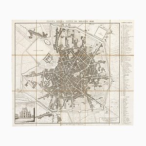
19th Century Map of Milan (Italy) - Antonio Tua, 1840
Map of Ancient Rome in the style of Ligorio, 1657

18th Century Map of Italy in Bright Colour

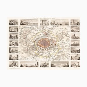
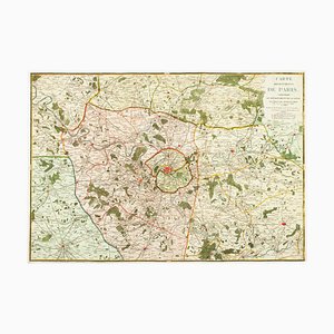
Paris and Surrounding Areas Map, Mid 19th Century
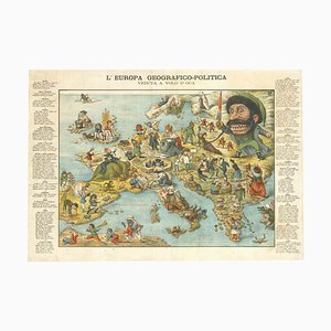
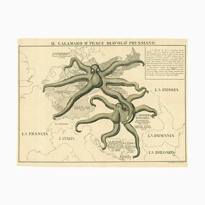
Italian Serio-Comic Map of Europe, 1871
Fantasy Map of Asia as Pegasus

The Famous Sea-Monsters Map of Iceland, 1595

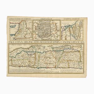
17th Century Map of the Holy Land Palestine, 1641
Mid-18th Century Map of Europe Showing the Spread of Religions
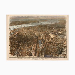
Balloon-View of Victorian Liverpool in Full Colour
Mid-19th Century Plan of Constantinople by Sduk, 1840s

Detailed Map of Knightsbridge, Chelsea and Kensington

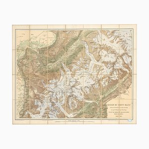
Map of the Mont Blanc Massif
Caricature Map of Italy

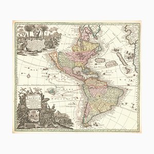
Map of The Americas with California as an Island, 1700s
Italian Serio-Comic Map of Europe During the Great War, 1890s

Map of the Environs of London in Fine Colour
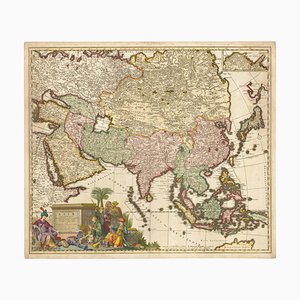
17th Century Map of Asia, 1690
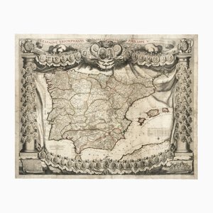
Antique Map of Spain Triumphant Under the Reign of Philip V by Nicolas De Fer, 1704
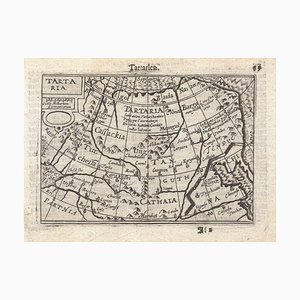
16th Century Miniature Map of Tartary by B. Langenes, 1599
Early 18th Century Map of London by N. De Fer, 1705
Map of France Celebrating the Military Successes of Louis XIV

18th Century Map of Italy in Fine Colour

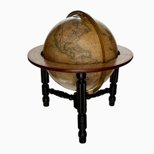
Mid-Victorian English Terrestrial Globe by James Wyld, London, 1870s
Rome's Pantheon, 1600s, Engraving

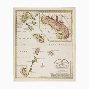
Early 18th Century Map of the Caribbean
Map of Italy with Plans and Views of Cities

17th Century Map of Luxembourg

Classic 17th Century Carte-À-Figure Map of Spain

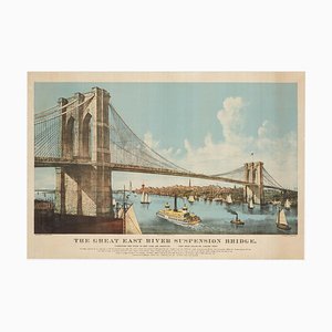
Large View of the Newly-Completed Brooklyn Bridge Poster
The Famous Wonderground Map of London, 1920s

16th Century Map of the Peregrinations of Abraham, 1603

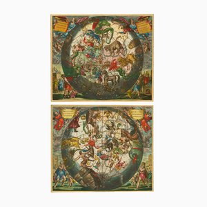
Antique Celestial Hemispheres Charts by Andreas Cellarius for Schenk & Valk, 1708, Set of 2
16th Century Map of Barcelona by Valegio, 1598

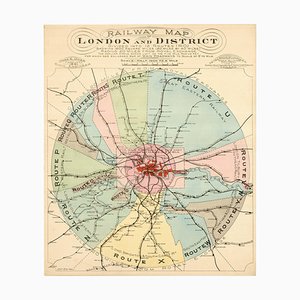
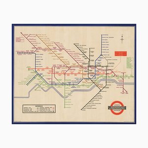
London's Railway Network, Late 19th Century
Plan of the Ottoman Siege of Belgrade, 1739
Mid-19th Century Town Plan of New York City

17th Century Map of China

Detailed Map of London During the Great Exhibition of 1851

Antique Map of London by Gabriel Gualdo Priorato, 1675
Tourists Map of New Yorks Subway System, 1954

17th Century Prospect of Lisbon

Map of the City and University of Oxford by T. Moule, 1848

A Collapsable Globe, 1920s

Prospect of Turin Map
Pictorial Map of South Africa from the Second World War, 1940s

Map of the Middle East from Lafreri
Tourists Plan of London for the Great Exhibition of 1851

Mid-17th Century Map of the Far East

18th Century Sea Chart of the English Channel
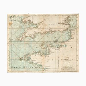
Chart of the Harbour of Havana

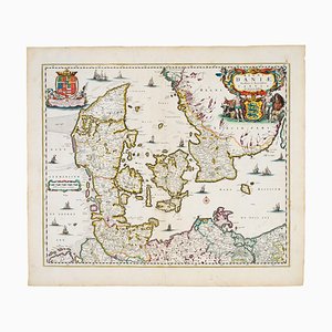
17th Century Map of Denmark
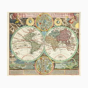
18th Century Double-Hemisphere World Map with Celestial Insets
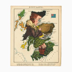
Satirical Map of Scotland
18th Century Map of Sicily

17th Century Wind Rose

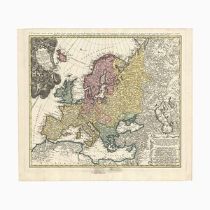
Wall Map of Europe According to the Congress of Vienna
17th Century Celestial Chart Showing the Ptolemaic Planetary Orbits

18th Century Map of Scotland

London Transport Underground A Double Crown Poster Map of the Tube by Beck, 1935
Early 19th Century Brass Navigators Tool by William Carys, 1800

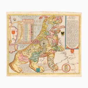
Antique Ecce, Quibus Hispaniar. Rex Philipp. Belgium (The First Leo Belgicus) Map by Michael Eytzinger, 1587
Prospect of Medieval London Bridge Covered with Houses

18th Century Maritime Explanatory Print

16th Century Woodcut Map of the World According to Ptolemy

Pictorial Map of Beijing by Frank Dorn, 1936
Early London Underground Platform Roundel, 1930

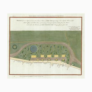
Early 19th Century Map for Houses in Hyde Park by J. Fordyce, 1809
The Environs of Paris Map, Early 19th Century
Prospect of Munich, Early 18th Century

18th Century Miniature Map of the British Isles by M. Seutter, 1744

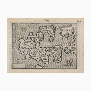
16th Century Miniature Map of Elba by B. Langenes, 1599
Spanish Sea Chart of Madagascar and Mozambique

First Issue of Rosaccios Map of Venice
Pirate Edition of Morden & Leas Map of London

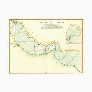
18th Century Map of the Persian Gulf
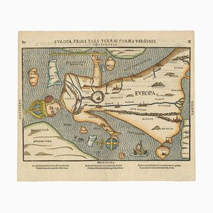
Ptolemaic Map of Italy

18th Century Town Map of Peking

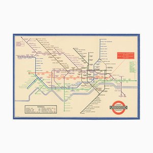
Map of the London Underground, 1930s
British WWI Propaganda Poster for Italian Readers, 1890s
Satire Against Napoleon Printed on a Handkerchief

Map of the Persian Gulf

Issue of John Speeds Map of Hampshire

Leicester Square Tube Station Roundel, 1940

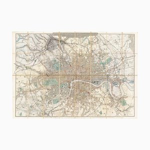
Large-Scale Survey of London Map with Marylebone & St Pancras

You Are Here Poster for London Bridge Underground Station

Map of the Oilfields in the Near East, 1955

Prospect of Bristol, 1600s

Trending