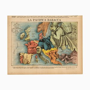
Italian Edition of Hadols Serio-Comic Map of Europe
¥227,521
You are now following Accessories. You can manage alerts in your account settings.
You have unfollowed Accessories.
Italian Edition of Hadols Serio-Comic Map of Europe
Allegorical Map of England

A Prospect of the Great Fire of London, 1600s
Post-War Pictorial Wall Map of London

You Are Here Poster for Holborn Underground Station

Map of Classical Arabia

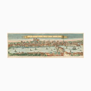
Panorama of Vienna Under Siege by the Ottomans

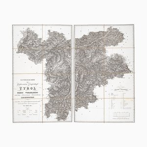
Detailed Map of Tyrol, Vorarlberg and Liechtenstein
Caricature Map of England and Wales

First State of the Tirion-Albrizzi Map of Japan

Map of the Netherlands with a Fine Maritime Cartouche by Enzo Mari

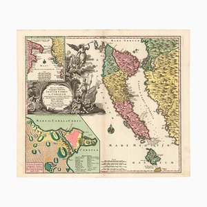
18th Century Map of Corfu in Original Colour
World Map as a Chocolatiers Competition, 1950s

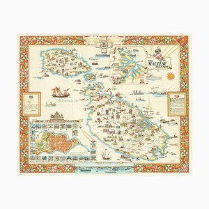
A Birds-Eye View-Map of Malta

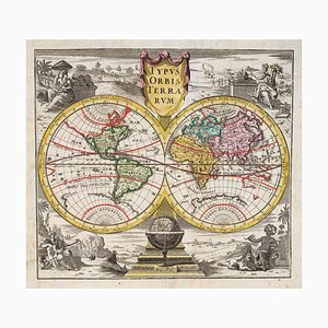
18th Century Double-Hemisphere World Map
Large and Detailed Chart of the Bahamas, 1700s

The City and Whitechapel from a Large-Scale Survey of London

Geological Map of England and Wales on Six Sheets, Set of 6

Caricature Map of Wales

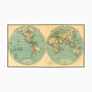
Late 19th Century Double-Hemisphere World Map in Cyrillic
Early 18th Century Map of the British Isles by N. De Fer, 1705

17th Century Prospect of Venice

Napoleon in Exile on St Helena

Decorative Marine Print of Early 18th Century Warships
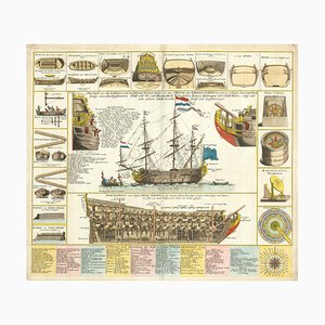
Early 18th Century Warship Chart

St. Johns Wood Tube Station Roundel, 1940

Holborn Tube Station Roundel, 1950

Early Underground Platform Roundel of London, 1950

Bank Tube Station Roundel, 1940

London Transport Underground Panel Wooden Lightbox, 1950s

Taiwan Map from Dutch East India Company, 1724

Large Chart of Jamaica, 1753

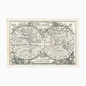
Miniature Double-Hemisphere World Map by J. Expilly, 1765
17th Century Miniature Map of Russia by Hondius, 1610

17th Century Miniature Map of Asia by N. De Fer, 1685

16th Century Miniature Map of Ischia by B. Langenes, 1599

Large-Scale Survey of London Map with St James's

Travel Poster of Malta by Ciqheri, 1950
18th Century Italian Map of the Cape of Good Hope by Albrizzi, 1740

Mid-18th Century Map of Taiwan by Bellin, 1748

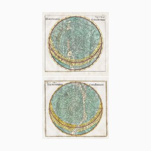
18th Century Celestial Charts of the Northern and Southern Skies, Set of 2
Caricature Map of Ireland

The Great Seal of the Commonwealth, 1651

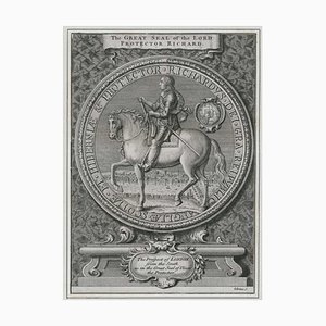
Great Seal of Richard Cromwell with a Prospect of London
Panorama of Stockholm

Unusual Balloon View of Brighton, 1840s

Venetian Edition of Danvilles Wall Map of Africa

17th Century Plan of Valletta

The Route of the Spanish Armada Around the British Isles

Three-Sheet Map of the Russian Empire

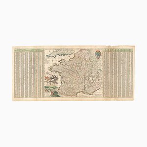
17th Century Map of France with Gazzetteer Side-Panels
16th Century Italian Map of Cambridge

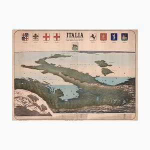
Upside-Down Birds-Eye View of Italy from the Alps
A 17th Century Engraving of the Zodiac Sign Aries

Maps of the World & Continents, Set of 7

A Birds-Eye View of Paris

16th Century Dutch Map of Cyprus, 1598

Classic Carte-À-Figure Map of the Netherlands & Belgium

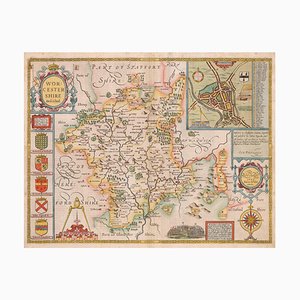
17th Century Map of Worcestershire, 1676
Map of New Zealand by Cook

18th Century Map Celebrating the Knights of Malta

A 17th Century Engraving of the Zodiac Sign Leo

16th Century Miniature Map of Cyprus

Map of the British Isles with Decorative Borders

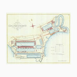
Detailed Plan of Londons Docklands
Wall Map of Europe Illustrated with Military Uniforms, 1890s

Pictorial Map of Russia

Covent Garden and Soho from a Large-Scale Survey of London

Early 17th Century Map of Wales, 1619

Pimlico and Belgravia from an Important Large-Scale Survey of London

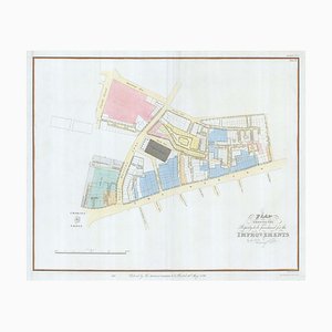
Plan to Redevelop the Corner of Park Lane and Piccadilly

Detailed Town Plan of Madrid

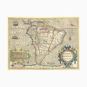
Early 17th Century Dutch Map of South America, 1633
Map of North America During the Mississippi Bubble

18th Century Map of Arabia with a Fine Border
Four-Sheet Wall Map of the Far East, Set of 4

17th Century Panelled Map of the Holy Land

A 17th Century Engraving of the Zodiac Sign Sagittarius

Figure Map of America

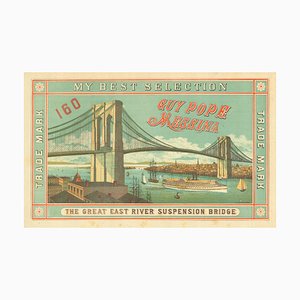
Scarce Advertising Orange Crate Label Featuring Brooklyn Bridge
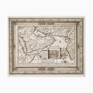
The Peregrinations of Abraham, 1603
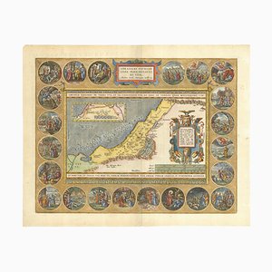
Orteliuss Landmark Map of China

18th Century Double-Hemisphere World Map

17th Century Dutch Sea Chart of the North Atlantic

18th Century Town Plan of the Hague

18th Century Two-Sheet Map of Ancient Greece from Aeg

Satirical Map of Ireland

Pictorial Map of Wales

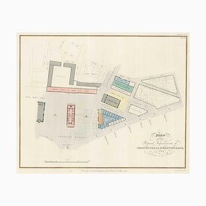
Planned Redevelopment of Charing Cross
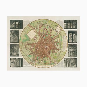
Map of Milan with Vignettes of Interiors
Nashs Plan to Redevelop Charing Cross
19th Century American Sea Chart of Hong Kong

Wall Map of Scotland

Two-Sheet Map of Ireland

Town Plan of Moscow in the 18th Century
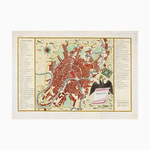
Chart of the Apparent Motions of Mars, Jupiter & Saturn

Trending