17th Century Engraving of the Zodiac Sign Libra
¥226,659

You are now following Products. You can manage alerts in your account settings.
You have unfollowed Products.
17th Century Engraving of the Zodiac Sign Libra
Caricature Map of Wales
Map of France Celebrating the Military Successes of Louis XIV

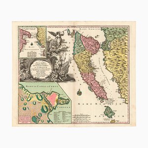
18th Century Map of Italy in Bright Colour

Figure Map of America
18th Century Map of Italy in Fine Colour

18th Century Map of the Papal States
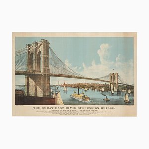
Large View of the Newly-Completed Brooklyn Bridge Poster
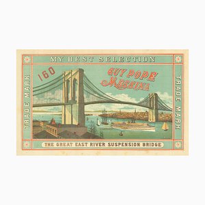
Scarce Advertising Orange Crate Label Featuring Brooklyn Bridge
Birds-Eye View of Louis XIV Court at Versailles

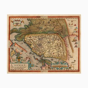
Orteliuss Landmark Map of China
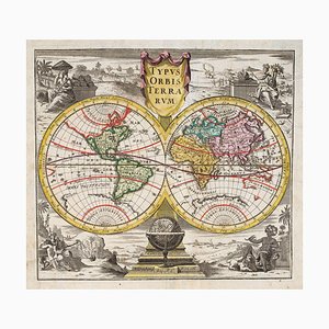
18th Century Double-Hemisphere World Map

English Double-Hemisphere World Map Showing Discoveries

18th Century Two-Sheet Map of Ancient Greece from Aeg

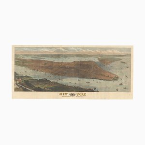
Highly-Detailed Prospect of Manhattan Poster
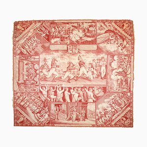
Satire Against Napoleon Printed on a Handkerchief
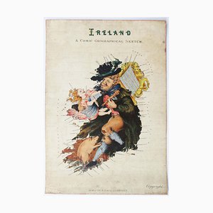
Satirical Map of Ireland

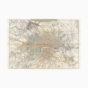
Map of the Environs of London in Fine Colour
Pictorial Map of Wales

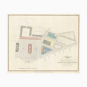
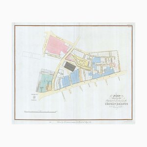
Planned Redevelopment of Charing Cross
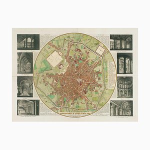
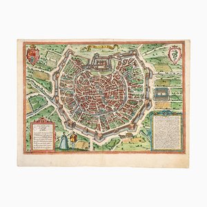
Map of Milan with Vignettes of Interiors
Nashs Plan to Redevelop Charing Cross
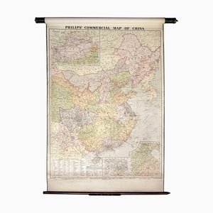
Wall Map Illustrating the Commerce of China
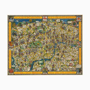
The Famous Wonderground Map of London, 1920s
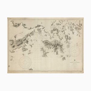
9th Century American Sea Chart of Hong Kong
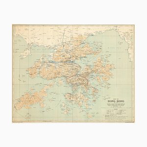
Map of Hong Kong, 1890s
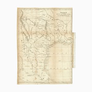
Map of the Republic of Texas
The First Plate of Orteliuss Classic World Map, 1584
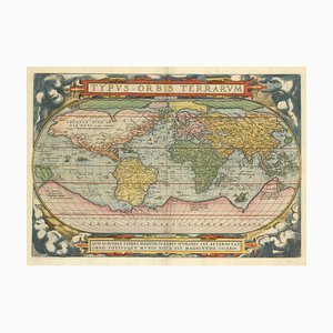
Chart of the Copernican Solar System, 1700s

Chart of the Apparent Motions of Mars, Jupiter & Saturn

17th Century Celestial Chart Showing the Ptolemaic Planetary Orbits

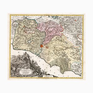
18th Century Map of Tuscany and the Papal States

18th Century Map of Scotland

Large-Scale Survey of London Map with Marylebone & St Pancras

Panorama of Vienna Under Siege by the Ottomans

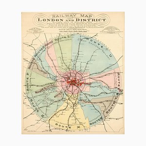
London's Railway Network, Late 19th Century
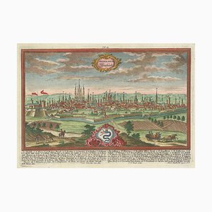
Prospect of Munich, Early 18th Century

18th Century Prospect of Milan with Allegorical Detail
Caricature Map of Ireland
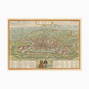
16th Century Plan of Rome
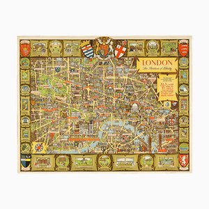
Post-War Pictorial Wall Map of London
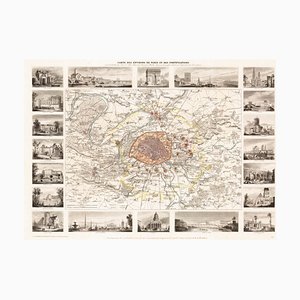
Paris and Surrounding Areas Map, Mid 19th Century
Map of Classical Arabia

Plan of the Ottoman Siege of Belgrade, 1739

17th Century Plan of Valletta

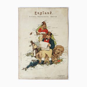
Caricature Map of England and Wales
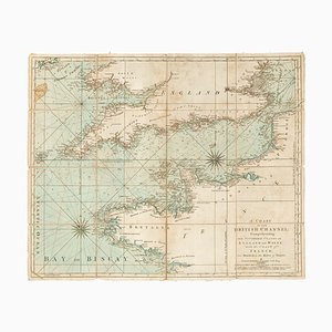
18th Century Sea Chart of the English Channel
Colourful Map of the History of London, 1970s

16th Century Italian Map of Cambridge

Upside-Down Birds-Eye View of Italy from the Alps
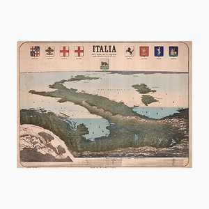
Chart of the Harbour of Havana

A Birds-Eye View of Paris

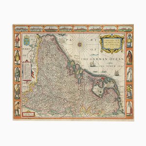
Classic Carte-À-Figure Map of the Netherlands & Belgium
Ptolemaic Map of Italy

Map of the Netherlands with a Fine Maritime Cartouche by Enzo Mari

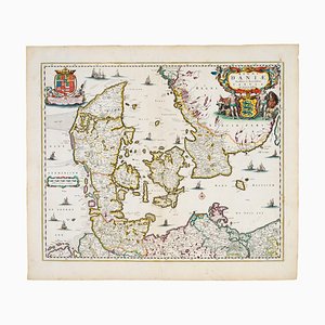
17th Century Map of Denmark
18th Century Map of Corfu in Original Colour
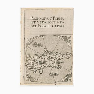
16th Century Miniature Map of Cyprus
18th Century Double-Hemisphere World Map
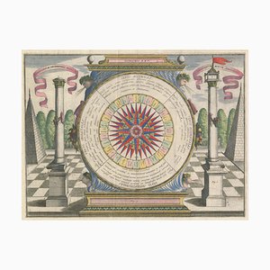
17th Century Wind Rose
Detailed Map of Knightsbridge, Chelsea and Kensington

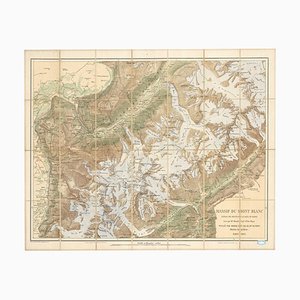
Map of the Mont Blanc Massif
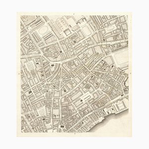
The City and Whitechapel from a Large-Scale Survey of London
Early 17th Century Map of Wales, 1619

Plan to Redevelop the Corner of Park Lane and Piccadilly

18th Century Town Map of Peking

18th Century Maritime Explanatory Print
View of the Great Fire of London, 1666, Etching

17th Century Map of the Turkish Empire

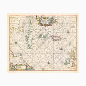
17th Century Dutch Sea Chart of the North Atlantic
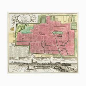
18th Century Town Plan of the Hague
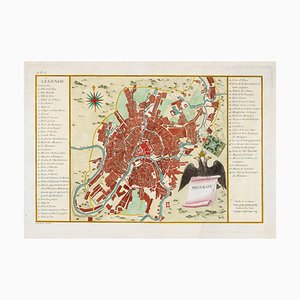
Town Plan of Moscow in the 18th Century
Pictorial Map of the World Promoting Protestant Missionary Work
Large-Scale Survey of London Map with Knightsbridge

You Are Here Poster for London Bridge Underground Station

Large-Scale Survey of London Map with St James's

Early Town Plan of Milan
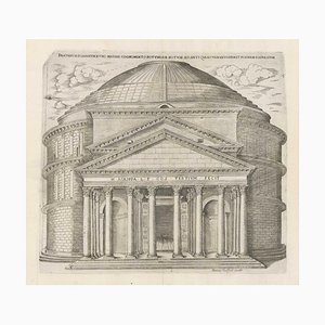
Rome's Pantheon, 1600s, Engraving
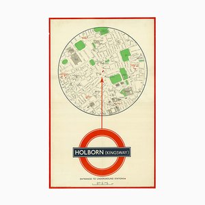
You Are Here Poster for Holborn Underground Station
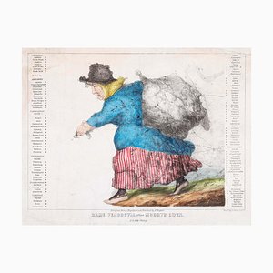
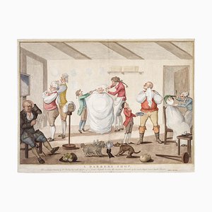
A Barber's Shop or A Satire of the Westminster Election of 1784, Late 1700s, Engraving
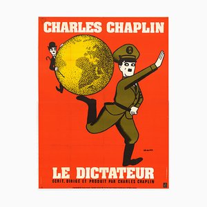
French Movie Poster for Charlie Chaplins the Great Dictator
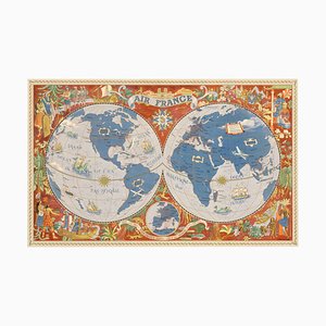
Air France Poster Map of the World in a Double Hemisphere, 1950s
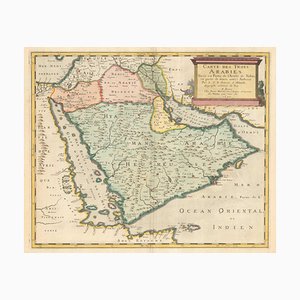
17th Century French Map of Arabia
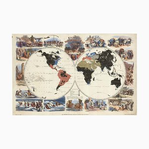
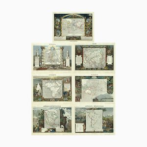
Maps of the World & Continents, Set of 7
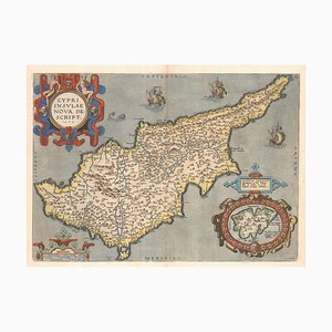
16th Century Dutch Map of Cyprus, 1598
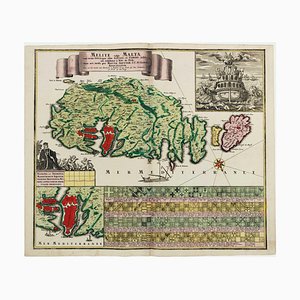
18th Century Map Celebrating the Knights of Malta
Covent Garden and Soho from a Large-Scale Survey of London
Map of the Environs of Hong Kong

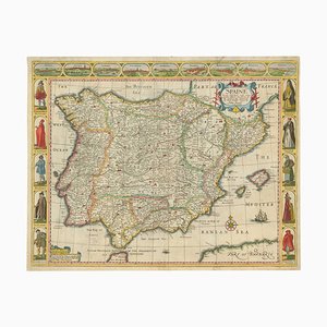
Classic 17th Century Carte-À-Figure Map of Spain
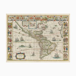
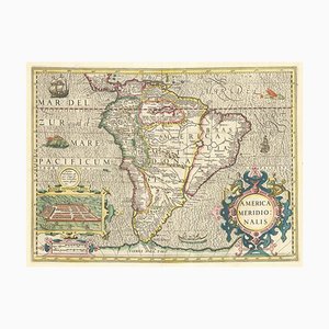
Early 17th Century Dutch Map of South America, 1633
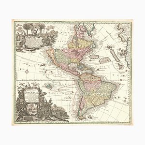
Map of The Americas with California as an Island, 1700s
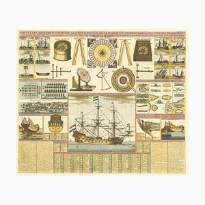
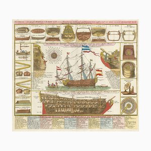
Early 18th Century Warship Chart
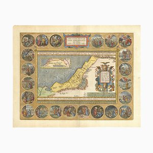
The Peregrinations of Abraham, 1603
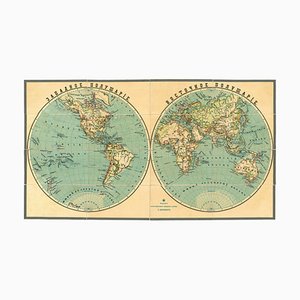
Late 19th Century Double-Hemisphere World Map in Cyrillic
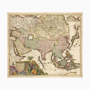
17th Century Map of Asia, 1690
Thomas Salmon, The Kaaba at the Temple of Mecca, 1738, Engraving

Trending