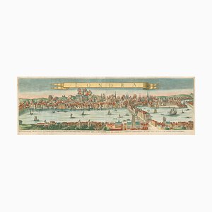
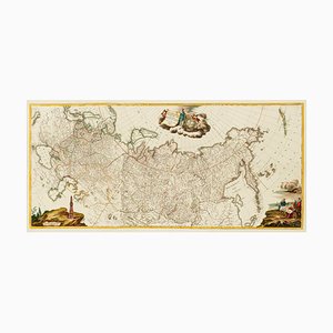
Large Chart of Jamaica, 1753
¥87,573

You are now following Products. You can manage alerts in your account settings.
You have unfollowed Products.
Large Chart of Jamaica, 1753
Tourists Map of New Yorks Subway System, 1954

17th Century Prospect of Lisbon

James Duffield Harding, View of Monte Carlo, 1836, Lithograph

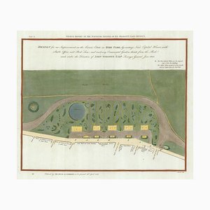
Early 19th Century Map for Houses in Hyde Park by J. Fordyce, 1809
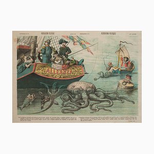
Satire Featuring the Famous Russian Octopus, 1884, Lithograph
A Sperm Whale Beached Near Scheveningen in 1598, 1700s, Print

Large-Scale Survey of London Map with Knightsbridge

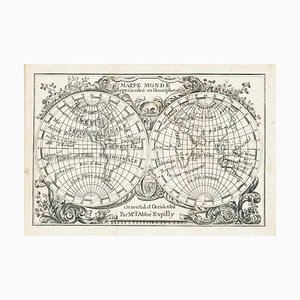
Miniature Double-Hemisphere World Map by J. Expilly, 1765
17th Century Miniature Map of Russia by Hondius, 1610

You Are Here Poster for London Bridge Underground Station

17th Century Miniature Map of Asia by N. De Fer, 1685

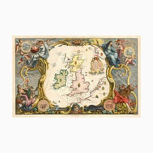
Early 18th Century Map of the British Isles by N. De Fer, 1705

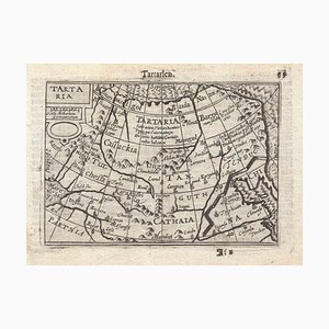
16th Century Miniature Map of Tartary by B. Langenes, 1599
16th Century Miniature Map of Ischia by B. Langenes, 1599

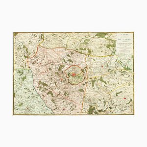
The Environs of Paris Map, Early 19th Century
16th Century Map of Barcelona by Valegio, 1598

Map of the Oilfields in the Near East, 1955

Large-Scale Survey of London Map with St James's

Map of the City and University of Oxford by T. Moule, 1848

George Morland, Anti-Slavery Scenes, Colour Prints, Set of 2

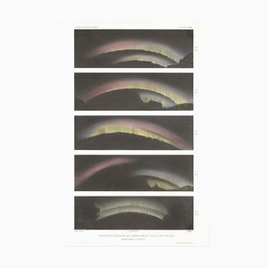
Paul Gaimard, Five Early Illustrations of the Aurora Borealis on One Sheet, Lithograph
Mid-19th Century Plan of Constantinople by Sduk, 1840s

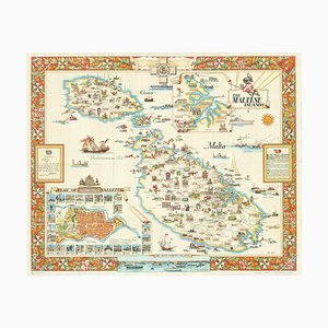
Travel Poster of Malta by Ciqheri, 1950
18th Century Miniature Map of the British Isles by M. Seutter, 1744

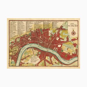
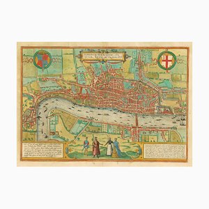
Early 18th Century Map of London by N. De Fer, 1705
18th Century Italian Map of the Cape of Good Hope by Albrizzi, 1740

Prospect of Bristol, 1600s

George Stubbs, Illustration That Introduced the Kangaroo to the British Public, 1700s, Print

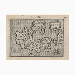
16th Century Miniature Map of Elba by B. Langenes, 1599
Mid-18th Century Map of Taiwan by Bellin, 1748

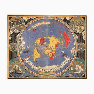
Great Circle World Map by Macdonald Gill
Map of Europe as a Queen from Buntings Itinerarium
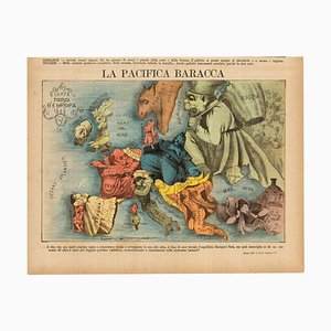
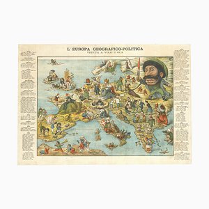
Italian Edition of Hadols Serio-Comic Map of Europe
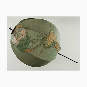
A Collapsable Globe, 1920s
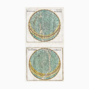
18th Century Celestial Charts of the Northern and Southern Skies, Set of 2
Allegorical Map of England

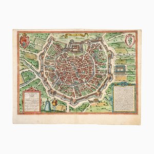
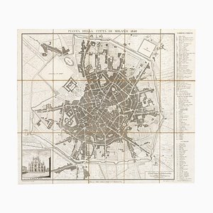
Early Town Plan of Milan
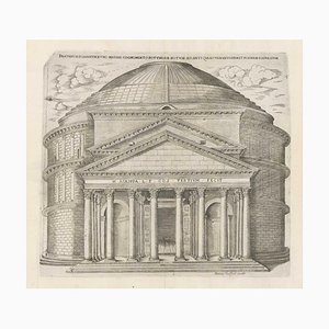
Rome's Pantheon, 1600s, Engraving
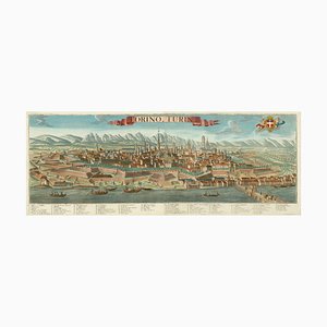
Prospect of Turin Map
19th Century Map of Milan (Italy) - Antonio Tua, 1840
A Prospect of the Great Fire of London, 1600s
Pictorial Map of South Africa from the Second World War, 1940s

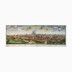
18th Century Prospect of Milan
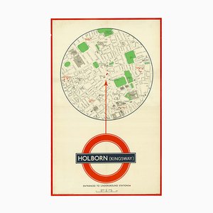
You Are Here Poster for Holborn Underground Station
The Great Seal of the Commonwealth, 1651

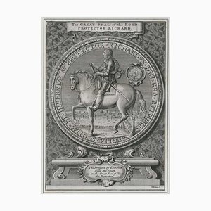
Great Seal of Richard Cromwell with a Prospect of London
Map of the Middle East from Lafreri
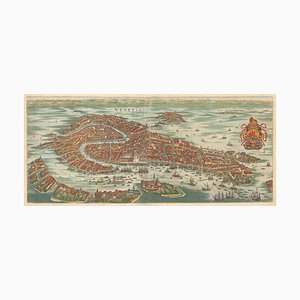
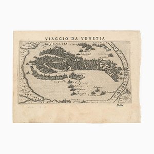
17th Century Prospect of Venice
Italian Serio-Comic Map of Europe, 1871
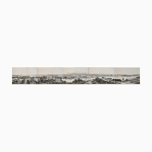
Panorama of Stockholm
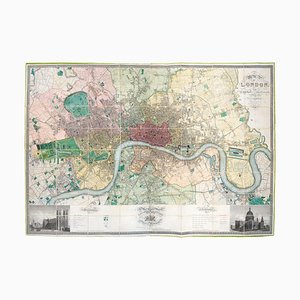
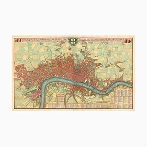
First Edition of Greenwoods Six-Sheet Plan of London
Unusual Balloon View of Brighton, 1840s

Caricature Map of Italy

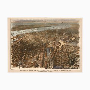
Balloon-View of Victorian Liverpool in Full Colour
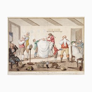
A Barber's Shop or A Satire of the Westminster Election of 1784, Late 1700s, Engraving
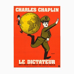
French Movie Poster for Charlie Chaplins the Great Dictator
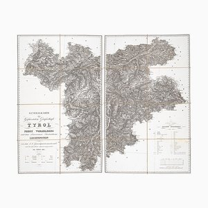
Detailed Map of Tyrol, Vorarlberg and Liechtenstein
Mid-17th Century Map of the Far East

The Route of the Spanish Armada Around the British Isles
First Issue of Rosaccios Map of Venice
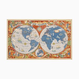
Air France Poster Map of the World in a Double Hemisphere, 1950s
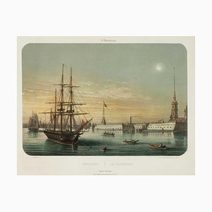
View of St Petersburg by Night - Lebreton, 1855
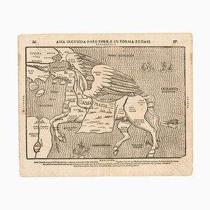
Fantasy Map of Asia as Pegasus
Three-Sheet Map of the Russian Empire
After Dutch Master, Still Lifes, Mezzotints, Set of 2

Printed Map of London
Map of Italy with Plans and Views of Cities

Pirate Edition of Morden & Leas Map of London
Map of Mungo Park's Search for the River Niger

First State of the Tirion-Albrizzi Map of Japan

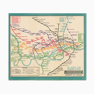
Last Pre-Beck Pocket Map of the London Underground, 1930s
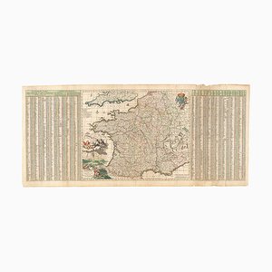
17th Century Map of France with Gazzetteer Side-Panels
French Artist, Memento Mori, 1800s, Lithograph

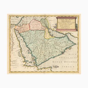
17th Century French Map of Arabia
A 17th Century Engraving of the Zodiac Sign Aries

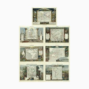
Maps of the World & Continents, Set of 7
Early Birds-Eye View of Havana
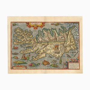
The Famous Sea-Monsters Map of Iceland, 1595
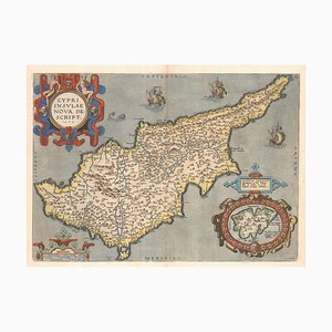
16th Century Dutch Map of Cyprus, 1598
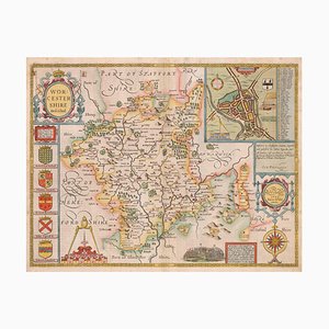
17th Century Map of Worcestershire, 1676
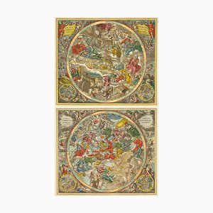
Celestial Charts with Christian Iconography, Set of 2
Map of New Zealand by Cook

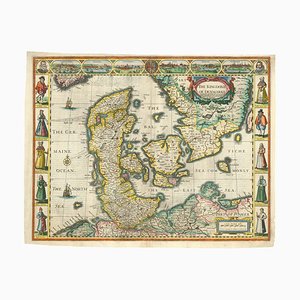
English Atlas Map of Denmark
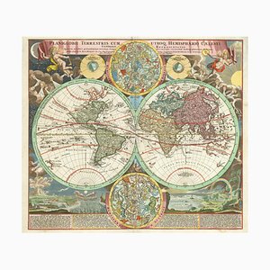
18th Century Double-Hemisphere World Map with Celestial Insets
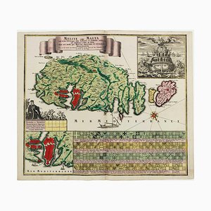
18th Century Map Celebrating the Knights of Malta
A 17th Century Engraving of the Zodiac Sign Cancer

A 17th Century Engraving of the Zodiac Sign Leo

Piranesi, View of the Piazza Navona, 1800s, Etching

Map of Ancient Rome in the style of Ligorio, 1657

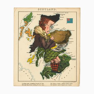
Satirical Map of Scotland
World Map as a Chocolatiers Competition, 1950s

Early 19th Century Original Table of Maritime Flags

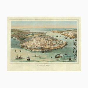
A Birds-Eye View-Map of Malta

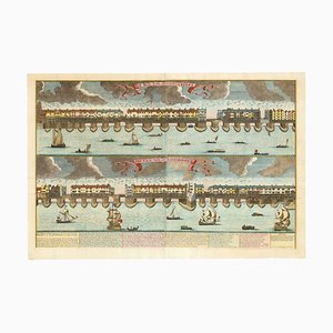
Prospect of Medieval London Bridge Covered with Houses
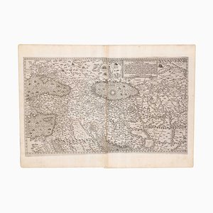
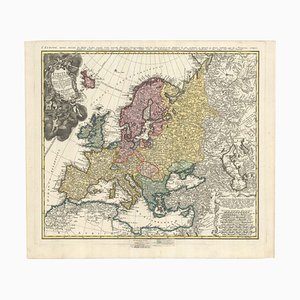
Mid-18th Century Map of Europe Showing the Spread of Religions
Trending