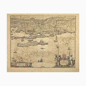
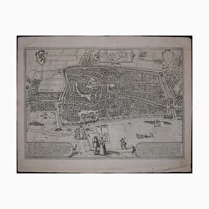
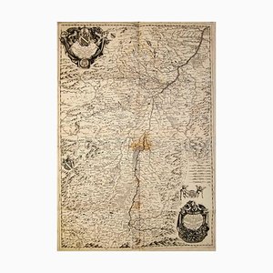
18th Century Map of Sicily
¥85,321

You are now following Wall Decor. You can manage alerts in your account settings.
You have unfollowed Wall Decor.
18th Century Map of Sicily
Mid-19th Century Town Plan of New York City

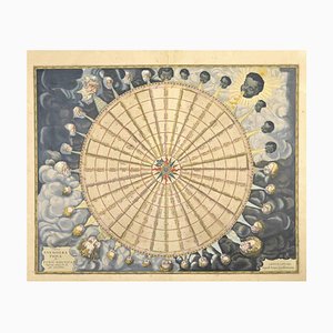
17th Century Wind Rose

Issue of John Speeds Map of Hampshire

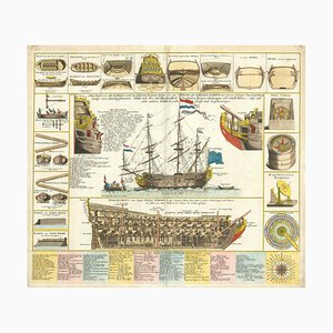
18th Century Maritime Explanatory Print

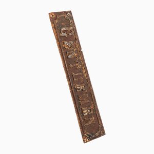
Large Cast Iron Gentlemen Sign, 1930s
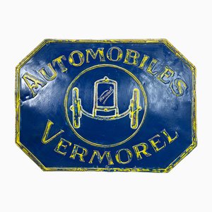
Vermorel Automobiles Sign in Metal, France, 1920s
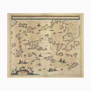
Johannes Janssonius, Antique Map of Archipela Meridionalis, Etching, 1650s
Enamel Laines Du Pingouin Sign by Ed Jean for Will Lacroix, 1930s

Japanese Meiji Era Wooden Cocoon Silk Trading Center Sign

Large Pottery Wall Plaque

Cartographic Map of the Russian Empire by Frederick De Wit, 17th Century

18th Century South German Red Ox Sign Bracket
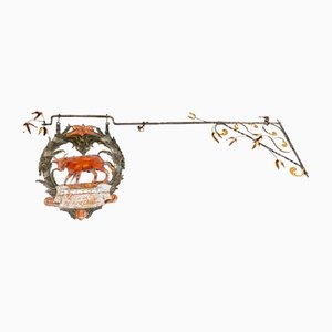
18th Century South German Sign Bracket with Reindeer

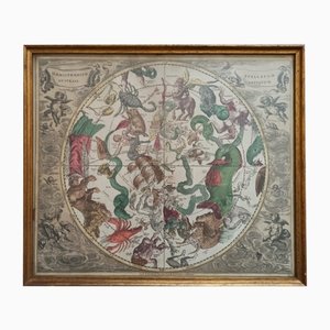
Celestial Chart, 1702
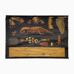
Antique European Mole Cricket Gryllotapla Rollable Wall Chart by Jung Koch Quentell
Edwardian Art Nouveau Copper & Oak Shop Sign

Stade, Antique Map from ''Civitates Orbis Terrarum'' - by F.Hogenberg - 1572-1617 1572-1617
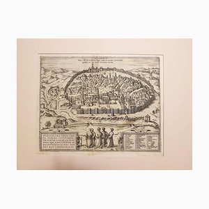
Jerusalem, Antique Map from ''Civitates Orbis Terrarum'' - 1572-1617 1572-1617
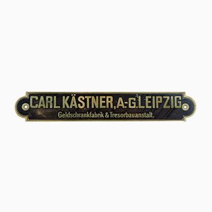
Carl Kästner Tresorbauanstalt Sign, 1920s
Vintage Dutch Papier-Mâché Butchers Trade Sign, 1950s

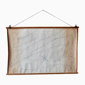
Vintage Linen School Map In the Dune

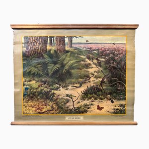
Vintage Linen School Map On the Heath
Vintage Linen School Map On the Edge of the Kalahari

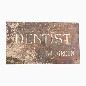
Vintage Brass Inlaid Dentist Sign, 1930s
Vintage Flames Neon Sign

Early 19th Century Map for Houses in Hyde Park by J. Fordyce, 1809
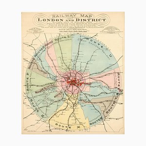
London's Railway Network, Late 19th Century
Prospect of Munich, Early 18th Century

18th Century Miniature Map of the British Isles by M. Seutter, 1744

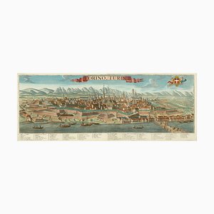
Prospect of Turin Map
Tourists Plan of London for the Great Exhibition of 1851

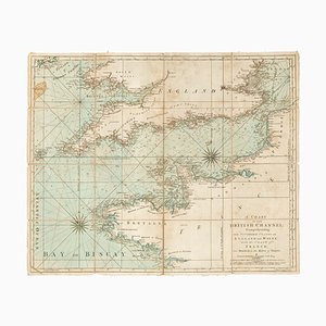
18th Century Sea Chart of the English Channel
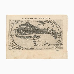
First Issue of Rosaccios Map of Venice
A Birds-Eye View-Map of Malta

18th Century Town Map of Peking

Geological Map of England and Wales on Six Sheets, Set of 6

17th Century Map of China

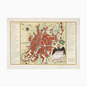
Town Plan of Moscow in the 18th Century
16th Century Woodcut Map of the World According to Ptolemy

18th Century Map of Scotland

Johannes Janssonius, Map of Dalmatia, Etching, 1650s
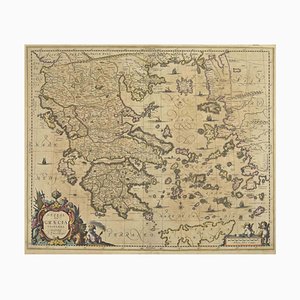
Johannes Janssonius, Antique Map of Greece, Etching, 1650s
Johannes Janssonius, Anemogra Phica, Etching, 1650s
Antique Naval Map of Australia, 1888

Utrecht, Antique Map from ''Civitates Orbis Terrarum'' 1572-1617
Large Wall Map by Heinrich Kiepert for Lithographische Anstalt Leopold Kraatz, 1886
Antique Bronze Train Sign, 1910s
Vintage Linen School Map

Vintage Linen School Map

Vintage Linen School Map In Ditch and Pond

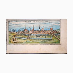
Prospect of Bristol, 1600s

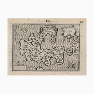
16th Century Miniature Map of Elba by B. Langenes, 1599
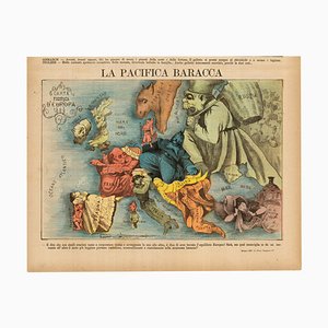
Italian Edition of Hadols Serio-Comic Map of Europe
A Prospect of the Great Fire of London, 1600s
Panorama of Vienna Under Siege by the Ottomans

Caricature Map of Italy

Venetian Edition of Danvilles Wall Map of Africa

Napoleon in Exile on St Helena

Pirate Edition of Morden & Leas Map of London

First State of the Tirion-Albrizzi Map of Japan

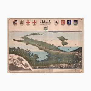
Upside-Down Birds-Eye View of Italy from the Alps
A 17th Century Engraving of the Zodiac Sign Aries

Ptolemaic Map of Italy

Map of the Netherlands with a Fine Maritime Cartouche by Enzo Mari

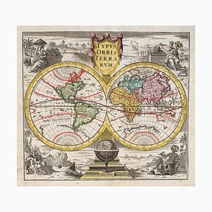
18th Century Double-Hemisphere World Map
The City and Whitechapel from a Large-Scale Survey of London

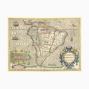
Early 17th Century Dutch Map of South America, 1633
Decorative Marine Print of Early 18th Century Warships
Caricature Map of Wales

Orteliuss Landmark Map of China

17th Century Celestial Chart Showing the Ptolemaic Planetary Orbits

Pictorial Map of the World Promoting Protestant Missionary Work

Antique Geographical Maps of the French-German War, Set of 4

Shōwa Kanban Hanging Sign in Wood, Japan, 1940s

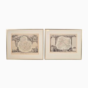
Antique Levasseur La Marne & Cote d'Or Wine Maps, 1852, Set of 2
Old Map of Etupes, 1833
American Red Cross Map of Italy, First World War, 1919

Vintage Metal Farm Sign, 1950s

Varsavia Superiore e Inferiore Etching Map by Vincenzo Maria Coronelli, Late 17th Century
Vintage Brown Hairdresser Sign
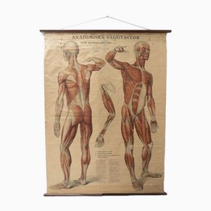
Vintage Swedish Anatomical Medical Wall Hanging
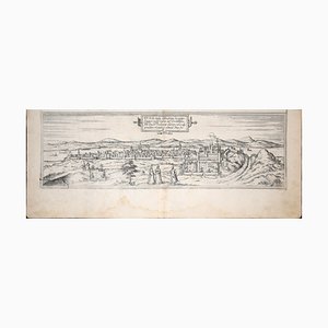
Moscow /Moscovia Antique Map, Civitates Orbis Terrarum by Braun and Hogenberg 1572-1617
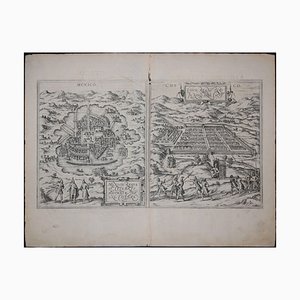
Mexico City & Cusco Antique Map, Civitates Orbis Terrarum by Braun & Hogenberg 1572-1617
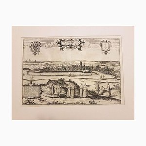
Danzig, Antique Map from ''Civitates Orbis Terrarum'' - 1572-1617 1572-1617
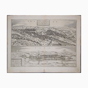
Prague and Egra, Antique Map from ''Civitates Orbis Terrarum'' 1572-1617
Buda, Antique Map from ''Civitates Orbis Terrarum'' - 1572-1617 1572-1617
Cardboard Sparta Cream Advertising Sign by E. Pohl, 1950s

Vintage Linen School Map

The Jolly Caulkers Signboard, Dover, UK, 20th Century

Dutch County Map of Cheshire by Janssonius, 1660s

Taiwan Map from Dutch East India Company, 1724

Advertising Sign Hand-Painted on Hardboard

Large Chart of Jamaica, 1753

Large-Scale Survey of London Map with Marylebone & St Pancras

Large-Scale Survey of London Map with Knightsbridge

Trending